A Map of the Geographical Structure of Wikipedia Links

Wikipedia
Click to enlarge!

There are a lot of Wikipedia visualizations. Some concentrate on article contents, others on the links between articles and some use the geocoded content (like in my previous blog post).
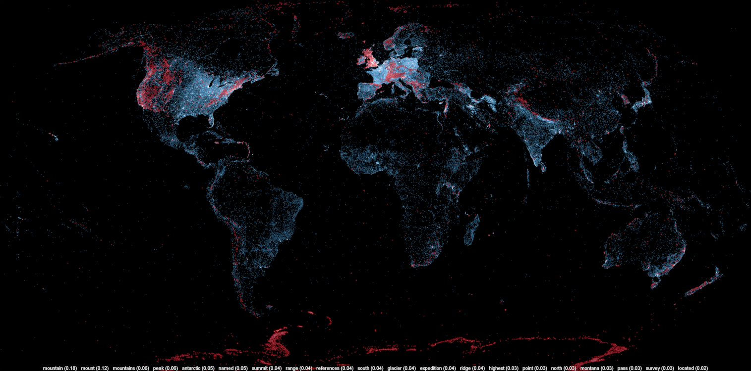
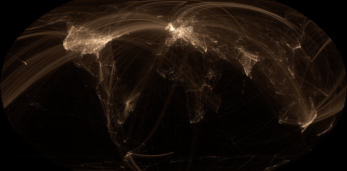
This new visualization is novel because it uses the geographical content of Wikipedia in conjunction with the links between articles. In other words, if a geocoded article (that is, an article associated with a location like a city) links to another geocoded article, a line will be drawn between these two points. The result can be found on the map on the left.

Read on for zoomed views, slideshows, browsable maps, etc.
Continue reading “A Map of the Geographical Structure of Wikipedia Links”

A Map of the Geographic Structure of Wikipedia Topics

Wikipedia Topic 260
Mountains, peaks, summits, etc.

A large number of Wikipedia articles are geocoded. This means that when an article pertains to a location, its latitude and longitude are linked to the article. As you can imagine, this can be useful to generate insightful and eye-catching infographics. A while ago, a team at Oxford built this magnificent tool to illustrate the language boundaries in Wikipedia articles. This led me to wonder if it would be possible to extract the different topics in Wikipedia.
This is exactly what I managed to do in the past few days. I downloaded all of Wikipedia, extracted 300 different topics using a powerful clustering algorithm, projected all the geocoded articles on a map and highlighted the different clusters (or topics) in red. The results were much more interesting than I thought. For example, the map on the left shows all the articles related to mountains, peaks, summits, etc. in red on a blue base map.  The highlighted articles from this topic match the main mountain ranges exactly.

Read on for more details, pretty pictures and slideshows.
Continue reading “A Map of the Geographic Structure of Wikipedia Topics”

Traquer les avions en temps réel avec une antenne et 20$

Google Earth ADS-BUn super-bidouilleur a récemment découvert qu’en utilisant une certaine marque (RTL) de clés USB pour écouter la télé, il était possible de capter et décoder une très grande partie du spectre radio à l’aide d’un petit logiciel (RTL-SDR). Plusieurs appareils, comme le USRP, permettaient déjà de le faire depuis quelques années, mais ces appareils étaient plutôt dispendieux et exigeaient des connaissances plutôt poussées en électronique et en informatique.
Cette fusion entre l’informatique et la radio est connue comme la “Software Defined Radio”, ou la radio définie par logiciel. En d’autres mots, des codes informatiques font le travail qui était auparavant effectué par des circuits spécialisés. Il devient donc possible de décoder des contenus seulement accessibles à certains spécialistes ou à l’aide équipement très dispendieux. Ces contenus incluent les informations émises par les avions, comme le ADS-B. Autrement dit, il devient possible de recevoir la localisation des avions de lignes en temps réel .
Continue reading “Traquer les avions en temps réel avec une antenne et 20$”

Limesurvey: How to import responses from a modified deactivated table

limesurvey_table_code A good number of my consulting clients use the very useful and powerful survey tool Limesurvey. Unfortunately, since version 1.92+, it seems impossible to reimport deactivated responses tables into new response tables if the survey was modified. I’m sure this doesn’t matter for long form surveys and mainly static surveys, but some of my clients use this platform as a dynamic form engine. In that case, forms can and will change over the duration of a project.
To resolve this problem and enable the importation of old responses tables, I’ve written a quick Python script. It uses MySQLdb, but that library should be installed by default on most Linux boxes. The script also requires a MySQL database backend but it should be easily adaptable to other database engines.
Continue reading “Limesurvey: How to import responses from a modified deactivated table”